
Using GeoServer as the Platform’s GIS server
We continue with news of the release 4.3.0-Quest for Onesait Platform because, in addition to generating a GIS library for Products and Projects, in this Q4 of 2022 we have been working on the implementation of a GIS server in Onesait Platform. According to the Onesait framework for GIS, the chosen server has been GeoServer.
Specifically, we have installed GeoServer version 2.22.0 on a PostgreSQL in its version 13 and the PostGIS extension with version 3.1.
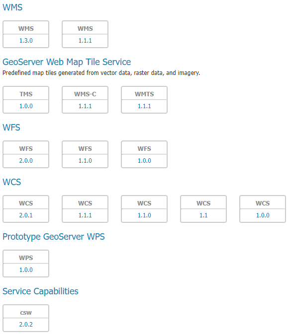
The server is currently running and serving layers in different OGC formats:
This will allow us, on the one hand, to enhance the Platform’s geospatial functionalities, being able to serve vector data not only from a GIS layer, as we were doing up until now, but also to generate a WFS service that will allow us to carry out more actions, mainly when editing geospatial data.
On the other hand, now the Platform will be able to directly serve image services that are optimized for consumption, something very practical and required in the different Products and Projects.
Next steps
We are currently working on the security aspects of the server, analyzing and configuring Single Sign-On and OAuth2 modules with Keycloak (both the Platform’s itself and external ones), to manage access and management of the data contained on the server.
Once we have defined the extensions that will be required, we will proceed to generate templates for the deployment of GeoServer with Onesait Platform when requested, being able to quickly configure which extensions are necessary and with what configuration.
We also plan to manage the GeoServer from the Platform itself through the GeoServer API, thus avoiding having to go to the GeoServer console to manage the Stores, Workspaces, layer creation, etc.
Header image: Juliana Kozoski at Unsplash.